Yukon Territory

Mackenzie Delta by Caroline Van Hemert

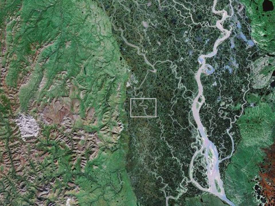
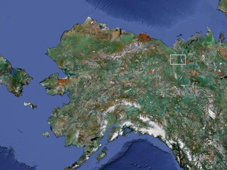
We have clawed, pried and cursed our way through the first 90 miles of the McKenzie delta, trying to find some humor in the ridiculousness.  On our first night out we measured all the squiggles of the meandering channel on the map and realized we had over 200 miles of boating to get to the arctic coast, not the 140 we had originally estimated.  The delta is a great place for ducks, swans, loons and terns but has been less hospitable to us.  With a strong north breeze overpowering the weak current it would be faster to travel up river.  We are tired not just from short and restless night, and physical exertion, but deep down tired.  Tired of the bugs, the mud, the brushy cut banks and most of all, the endless headwind that wears on our nerves and our joints.  The coast will be a much needed break from the monotony of flat water pack-rafting and we are exciting to start walking again.  Fortunately as time passes usually so do the miles.  In the meantime we hope for calmer weather. *No new photos but Caroline was able to send their approximate location so we can picture where they are based on some Google Map screen shots.  If you want to explore a map on your own they are approximately 10 miles south of Aklavik, NT, Canada on a western channel of the river.


Solstice by Caroline Van Hemert

It’s not often we remember exactly where we were 10 years ago to the day.  On this year’s summer solstice, however, the recall was easy.  As we drifted toward the confluence of the Wind and Little Wind rivers, we met a familiar view of the low-lying Illtyd Mountains. On our first trip into the Wind River drainage in 2002, we hadn’t heard of a packraft but, similar to this visit, intended to hike in and paddle out.  The concept was beautiful—we would go “ultra-light,” bringing only the tools necessary to build the canoe rather than the canoe itself.  These tools included a bow saw blade, small axe, froe, drawknife blades, and pot for steaming roots.  We spent 2 months hauling food and gear over the continental divide, building a bark canoe at the headwaters of the river (spruce as no birch were available), and, eventually, paddling the 300 miles to Fort McPherson.  The enormous amount of food we carried in, though insufficient to meet our needs, made travel slow and cumbersome, forcing us to double carry.  The bright idea, though ultimately executed, had us hanging by the skin of our teeth—short on food, short on time, and with little safety margin.

This time around, we employed a different strategy, moving fast and light, covering the same number of miles in 13 days rather than 60. The packrafts and their amazing portability—weighing in at under 8 lbs fully outfitted—made this feasible.  Our route was different as well, hopscotching between floating and hiking, connecting adjacent river valleys.

From the Tombstone Mountains, we hiked into the West Hart River, passing alpine flowers in bloom, a lanky brown-black wolf, and several caribou.  Nests housing the tiny eggs and downy chicks of Arctic Warblers, White-crowned Sparrows, and other breeding songbirds dotted the thickets of willows and alders.  After 25 miles of walking we finally had enough water to begin bumping along and we happily left the mud and tussocks behind.  Knowing almost nothing about the headwaters of the river, we were anxious to jump in but uncertain about what it might bring.  The river became more exciting as we traveled downstream, encountering plenty of whitewater to keep us on our toes.  Class III ledges and boulders followed mellow gravel bars, winding from colorful canyon walls to forested bluffs. A moose and her brand new calf swam the river just ahead of us.  Mergansers and Harlequin Ducks bobbed along in the waves.  Too soon we reached the confluence with the main Hart River where we loaded the boats onto our backs once again.

We waded across Waugh Creek’s crystal clear water many times, following game trails through willows and alder.  The creek led us by deep pools beneath rock faces that later gave way to wide valleys with massive ice as thick as 6 ft deep, 1 mile long, and half a mile wide.  Called “aufice,” or “glacier” by locals, it is formed by freezing from the “bottom up,” in which layer after layer of water (overflow) builds throughout the winter.  Unlike the deep snow in the Tombstones, the ice provided good walking with a break from the bugs. Tussocks with swarms of mosquitoes and blazing sun slowed our progress, sending us search in vain for better terrain.  Finally, on Forrest Creek, we gladly traded bushwhacking for cottongrass, then at last said enough and dropped our packs and inflated our rafts. We put in early and got hung up early, unable to outrun mosquitoes as we drifted along.  The Little Wind brought plenty of water for our boats and at last we spilled into the Wind River, familiar ground to us.  As the walls of the Peel Canyon rose around us, an an eerie “chreee” of a Red-tailed Hawk (in our minds-eye, perhaps the same bird we heard 10 years earlier) set the tone as we slid into a wave train.  This time, with lower water levels and manufactured boats, we were relaxed.  Last time, we found ourselves way out there, gripping whittled paddles, unsure of the breaking point of our canoe.  Thinking back to summer solstice spent at our canoe-building camp on the upper Wind River—a couple of kids with an outrageous idea and a heap of optimism—our practicality on this go-around might almost be called boring.  But, fortunately, things rarely go according to plan.

70 miles from Ft McPherson, as we choked on mosquitoes and smoke from forest fires burning all around us, we also remembered why we pulled 16 hour days in the canoe, paddling mile after mile along the sluggish river.  But this time, speed was not on our side.  Though the packrafts have made this trip possible, they can’t compete with the bark canoe in flatwater paddling.  With a stiff headwind leaving us at a near standstill, one and then both of us retreated to the shoreline, stumbling downriver through mud and brush.  Sinking up to our knees in the shoe-eating muck, at times we had to resort to a full crawl to extricate ourselves.  Thunder and lightning storms raged, stirring up dust devils on the gravel bars and casting a dramatic hue to our misadventures.  Morale waned a bit as what should have been an easy day of boating turned to two days of mud-bogging on empty bellies.  Persistent aches and pains have been nagging as well—it’s often a blurry line between chronic discomfort (which is a given on a trip like this) and injury.  This leg seemed to bring some of the highest highs and lowest lows yet, and the mud and mosquitoes incited the latter.  There is a beauty in the rawness of a place like this, in which crossbills and goshawks thrive but humans suffer.  But appreciating the scenery through a headnet takes a certain kind of grace and humility of which I find I’m only intermittently capable.

A box of cookies and quart of chocolate milk helped to lift our spirits as we made it to the joint store/post office/gas station in Ft McPherson.  Since arriving here, we’ve already met several folks whose families have hunted, fished, and trapped in this area for generations, sharing stories about travel by dog team, canoe, and Skidoo.  They also cautioned us about the vulnerability of the entire Peel River watershed to development pressures and ask that we help to bring awareness to these issues (ProtectPeel.ca).

As we head north toward the Arctic coast, we will leave the trees behind and enter the enormous web of the McKenzie River Delta.  We have another 140 miles of boating (let’s hope that north wind goes easy on us!) and 90 miles of walking to reach Herschel Island. Internet and phone are hard to come by, so updates and photos may be a bit delayed but we’ll do our best to keep them coming.  We’re thinking of you all, especially Kate & Nate and their new arrival!  Thanks as always for the encouragement and emails—they mean a lot to us!

Little Wind River by Caroline Van Hemert

A quick update from Caroline and Pat via satellite phone. Caroline and Pat reached the 2,000 mile mark of their journey on the solstice.  They made it to the head waters of the Little Wind River and are travelling onto the Wind River, which they hope to make in two or three days. They can raft for the most part but some of the stream is braided and shallow. They are having very warm and sunny weather which also makes for lots of mosquitoes and a very warm tent.

Several people have inquired as to whether they would be passing by the site of their spruce bark canoe building adventure on the Wind River about 10 years ago. They will actually enter the Wind River about 70 miles downstream of the site.

Tombstone Mountains by Caroline Van Hemert

Traveling seventy miles through the Tombstone Mountains from Dawson, we cursed ourselves for not fully appreciating the canoe! Dense alders and willows, postholing in thigh-deep snow, and mosquitoes were the tolls required to get a glimpse of the stunning granite spires for which these mountains are known. Locals in Dawson pointed us toward a route that followed part of the historic, 100-year-old "ditch" that diverted water to the goldfields at Bonanza Creek. This ambitious engineering feat has been compared in scale to the Panama Canal and some of the same steam-powered backhoes were used in the construction of both projects. With recent warm conditions and accelerated snowmelt, creeks were swollen and much of our route was very wet and muddy. In the low country, we encountered dense brush and muskeg and in the high country, met deep snow, leaving little in between for decent travel. Occasionally we found good caribou and other game trails, but even these had largely turned to gushing streams in the wet conditions. The route we eventually chose, a compromise between negotiating steep terrain and high water levels, led us over two passes and across several icy creeks, one more than waist-deep. We found ourselves punching through soft, deep snow for hour after hour in running shoes, following the tracks of caribou and bears, who travel these passes regularly. Several alpine lakes in the area provide nesting habitat for sea ducks, but these were still ice-covered as we passed. A single White-winged Scoter surfing the whitewater of Little Twelve Mile River may have been biding her time waiting for the late break-up. American Pipits, Snow Buntings, and Gray-crowned Rosy-finches braved the snow to find small patches of exposed tundra and a pair of Golden Eagles greeted us, along with wind and snow showers, at 6000'. Unfortunately, rowing, packrafting, and canoeing left us with tough hands but tender feet and it will take some time to harden up our soles again.

We left the dramatic peaks and expansive views of the Tombstones and hiked down to the Park's interpretive center, where staff generously held our resupply, left by my parents on their recent visit. We won't have a rest day here as we're already cutting into provisions for the next leg and need to keep moving. We're sending this update on a borrowed internet connection as there is no phone and only limited infrastructure here. As we travel through increasingly small and remote communities, communication will be much more limited.

We're heading off today on what we anticipate may be one of the most challenging legs of the trip. Our plan is to hike into the Hart River, packraft a section of this, then cross through the Wernecke Mountains to the Little Wind River. From here we hope to paddle to the "big" Wind River and rejoin our route to Fort McPherson, which we did in a bark canoe almost exactly 10 years ago. We have little information about the headwaters of these rivers and hope they will be suitable for packrafting. If not, the hiking will be slow and painful. Even as proposed, we have a long slog through tough terrain ahead of us. We will keep our eyes out for trails and route clues left by caribou, moose, wolves, bears, and other critters who travel through these wild lands.

Dawson City by Caroline Van Hemert

New photos in the gallery. After  a week and 440 miles on the Yukon River, we pulled into picturesque Dawson City yesterday evening.  The stream flow in Whitehorse was quite low when we left, but heavy rains upstream have since created high water conditions and fast travel (and several closures along the Alaska Highway).  With steady paddling and a swift current, we were able to cover up to 80 miles a day.  After chasing spring for the past 1,800 miles, we’ve finally caught up with summer, evidenced by the emergence of mosquitoes, green-up, and the abundance of breeding birds.  The ice left Lake Laberge only days before we paddled through, but temperatures in Dawson are now in the 80s—when the seasons change up here, it happens fast!

Though a more traveled route than most that we will encounter on our journey, the Yukon River corridor provides home for many species of wildlife and birds.  Moose, black and brown bears, and dall sheep cruised the shoreline and adjacent slopes.  We encountered large flocks of Surf Scoters and Long-tailed Ducks on Lake Laberge.  Flycatchers, kingfishers, and spotted sandpipers darted across the river and called from its banks.  Thousands of Bank Swallows nested in the high river cutbanks, sometimes burrowing into the visible white ash layer deposited by an Alaskan eruption some 1,300 years ago.

Passing through infamous Gold Rush country, signs of previous travelers abound.  One night we camped at “Thom’s Place,” a classic log cabin where a fellow lived briefly and then died, alone, as seems to be the story of so many during these boom and bust times.  The much longer-lived history of First Nations tribes in the area trace back thousands of years, with historic travel routes that connect the coast and the interior, some of which parallel our path from Haines.  Though the classic Gold Rush days have ended, mining is still very much a reality in this area.  Many of the small claims of the past have been replaced by industrial mining operations, with associated dredges, roads, and growing power demands.  Natural cycles of disturbance in the form of fire and flooding are evident as well, with huge burns along significant stretches of the riverbank and many old structures that have been taken by the river.

With a population of 1,800 people, Dawson is the last “big town” we’ll pass.  This town visit brought much more excitement than just ice cream and clean laundry—my parents took a road trip from Anchorage to meet us here!  We’re thoroughly enjoying our mini-vacation, complete with Rose’s fresh-baked goods and Willy’s gear hauling services.  Any of the weight we may have lost on previous legs has since been recovered (and likely surpassed!).

Our next leg will take us from Dawson into the Tombstone Mountains.  After floating down the Yukon in a canoe, this stretch of walking will whip us back into shape.  Although the Tombstones are renowned for great alpine terrain, we expect to encounter lots of brush and late-season snow en route.  High water also means frequent and challenging creek crossings.  Though only 70 miles to the Dempster Highway and our next resupply, travel here will almost certainly be slow.  However, we’re looking forward to hiking again—sitting for many hours at a time requires its own form of endurance!  From the Dempster, we’ll head into the Hart River drainage, eventually connecting to the Wind and Peel Rivers.  Hope everyone is enjoying the start of summer and, for those of you in the north, the glorious midnight sun!

Whitehorse by Caroline Van Hemert

Check out the new gallery of Haines to Whitehorse photos. We arrived in Whitehorse yesterday after our trek up and over the mountains and into the headwaters of the Yukon River.  Shortly after launching from the cabin in our packrafts, we found ourselves treading water into a stiff north breeze.  Though we were able to ferry sideways, we made almost no headway, continuing to slip to the south. These small inflatable boats are easily pushed around, especially when loaded with packs and skis, and a headwind can be a showstopper. As whitecaps began lapping at our dangling skis, we considered abandoning the crossing. Fortunately, the wind eased rather suddenly and we were able to continue on to Seduction Point and across to the east shore.  Along the way we encountered a group of incredibly curious and playful sea lions.  We felt a bit vulnerable in our beach ball-like rafts as we watched them swim in the clear water beneath our boats, flipping and diving just feet from us.  We finally landed on the rocks north of Yeldalga Creek and loaded the boats onto our packs for the long uphill slog.

Travel through the mature hemlock forest was steep but surprisingly decent for southeast Alaska.  Thankfully, with spring's late arrival, the Devil's Club had not yet sprung up. We hit snow line at approximately 1500' and were thrilled to take the skis and climbing skins off our backs and put them on our feet.  By late evening we made it up to treeline at the base of the cirque.  We got up early the next morning, hoping that the snow would firm up overnight, but with warm temperatures that didn't drop below freezing, the snow remained wet and heavy.  According to a local pilot, the last spring storm cycle dumped 6' in the mountains--this made for good coverage but slow trailbreaking as we headed up to the col.  As we scrambled quickly over avalanche chutes, we felt confident that the previous days' warm temperatures and sunshine had cleared most of the snow from the rock faces above.  Light rain turned to snow as we neared the col at 5000'.  Descending eastward over the other side didn't offer the great ski run we had hoped for, but instead left us slowly picking our way down in flat light and fog.  Several wet slides came down from the adjacent saturated slopes.  Relieved to reach the valley below, we followed the broad Sinclair Glacier (otherwise known as the "Dead Glacier") downslope .  Due to the wet, rotten snow conditions, we decided to try an alternate route to access the Mead Glacier (slightly different from the hypothetical map posted last week).  This option would keep us off the steeper slopes prone to slides but presented the challenge of getting off of one glacier and back onto another.

We continued down several thousand feet to the glacier's terminus.  Crevasses were easily avoided so we skied unroped and were glad to find an easy exit onto the patchy snowfields of the creek bottom.  Mountain goats traveling on precarious faces above us kicked down an occasional rock.  Alternating between skiing and carrying our skis through talus fields and along the brush and gravel that lined the river, we continued downstream.  We made camp on a knoll overlooking a glacial lake with ice fins towering above.  A few hardy ducks, gulls, and terns frequented the lake and we watched a beautiful black bear amble by.  In the morning we worked our way across several creeks to the east shore of the lake but quickly realized that access onto the glacier would not be possible here without technical climbing gear, which we lacked.  From our new perspective, the western shore of the lake looked more promising.  All of the water from the creeks and lake funneled below the glacier, producing a bridge of rock-covered ice.  We traversed around the lake and before long we were walking on the broad, flat Mead Glacier.  A moon-like landscape of rock-studded blue ice soon gave way to snow and we happily donned our skis again.  Trudging along in a drizzle, we veered north off the Mead  and camped on the medial moraine of an unnamed glacier just before the Canadian border.

A headwind greeted us in the morning as we continued toward the divide.  In glaringly flat light, we were surprised to see other travelers in this starkly white landscape.  What looked like a rock from a distance turned out to be a Trumpeter Swan enjoying a bath in a perfectly blue glacial lake.  We watched a small flock of swallows fighting their way into the fierce headwind, toggling back and forth to switchback into the gusts.  Yellowlegs and pipits called as they flew by in the distance and a Rough-legged Hawk passed overhead before catching a thermal and rising into the clouds.  This mountain pass appears to be a prominent flight path for birds heading from the Katzehin River into the interior.  At approximately 4000' the steady climb eased and our skis tipped downhill into the Yukon River watershed.  Though tidewater of the Pacific lies only 25 miles away, snowmelt here will travel nearly 2000 miles to the Bering Sea.   Happily, our descent off the glacier posed no steep icefalls to negotiate, in contrast to what is typical on the west side of the range.  After passing several glacial lakes, we reached a creek that would become the Swanson River.  The dry pine forest immediately presented a dramatic contrast to the hemlock and spruce of southeast Alaska.  We left the river as it dropped into a rocky canyon, only to find that we were boxed in by a similar canyon formed by a tributary creek on the other side. We skied upcreek until we found a snowbridge to cross--this turned out to be lucky timing as the bridge collapsed overnight while were camped on the far side. 

The next day we skied through the forest and along gravel bars.  Before long, tree wells became more abundant than the snow and we wasted time and energy wiggling through tight spots, sliding into holes, and extricating ourselves from various awkward positions.  Eventually we reached a cutbank with a waterfall and cliffs above, leaving the river as the only option for travel.  We inflated the boats and, with skis and heavy packs lashed onto the bows, slid into the swift current.  We scouted the first several sections, occasionally carrying around shallow rocks.  Soon our confidence increased and we rounded bend after bend, loving the free ride down this river we had not anticipated being able to float.  Several miles later, the turquoise waters  of Tagish Lake appeared.  This formed the gateway to the inland waterway we would follow for the next 120 miles. 

The lake offered fantastic camping and gorgeous views.  After spending seven weeks on the ocean, we had to retrain ourselves to stop thinking about tides and currents and remember that we could simply dip our cup in for a drink.  No sea lions or whales would be coming by for a visit--distractions we soon missed.  A steady tailwind helped our progress without stirring up the large waves encountered on the ocean. When we tired of flatwater paddling, we walked the shoreline.  In clunky ski boots this made for slow going but we enjoyed seeing the abundance of wolf, bear and other tracks and hearing the lively chorus of songbirds in the forest.  We watched caribou, moose, fox, porcupine, and beaver travel along the beaches and shorebirds feed in the shallows.  Passing by the Tagish Wilderness Lodge, owners Sarah and Gebhard treated us to a delicious hot meal and helped stretch our provisions for the last 65 miles to Whitehorse.  We enjoyed hearing stories about their remote year-round existence and the operation of an off-the-grid lodge.  We also learned that the ice had departed from the lake only a few days prior to our arrival. 

Marsh Lake, true to its name, offered muddier walking but lots of bird activity.  We saw large flocks of shovelers, pintail, wigeon, teal, swans and many of the same species that accompanied us along the coast--White-winged Scoters, mergansers, goldeneye, Long-tailed Ducks, Whimbrel (perhaps some of the satellite-tagged birds whose route we have been paralleling!), yellowlegs, and Pacific and Red-throated loons.  Spotted Sandpipers and Semi-palmated Plovers busily worked the shorelines.  Warblers, sparrows, thrushes, grouse, snipe and a Boreal Owl called and sang late into the evening.

Finally we felt the welcome pull of the Yukon River.  We drifted under the bridge of the Alaska Highway, 20 river miles from Whitehorse.  Still slow-moving at this point, we paddled along the river for most of the day before reaching the dam that provides hydropower for the area.  We pulled out and walked the final stretch to the campground.  The post office was closed by the time we  made it to town, so we tromped around the grocery store in ski boots, anxious to swap these out for lightweight hiking shoes.  As often happens in the north, we randomly crossed paths with friends on other adventures during our short stay in Whitehorse. The next leg will be a vacation of sorts as we travel by canoe down the Yukon River to Dawson. The canoe will be speedy compared to the packrafts and space is much less limited--this means more food and a book to read!  Thanks for your comments and emails--we enjoy hearing from everyone along the way.